Technical subcontracting
Your firm contracts with the client, and FAE performs the agreed aerial component. You receive FAE's quotation and set your own offer to the client. Your firm retains project coordination and the commercial relationship.
You coordinate the work and the client relationship. FAE handles the agreed aerial acquisition, processing and deliverables, complementing your firm's team and technology.
Discuss a partnershipMention ‘FAE Partner’, your firm, the services of interest and your first project, if you have one.
References from FAE’s historical portfolio: Orange, Huawei, Petrom/OMV Petrom and the Government of Romania.
View FAE’s historical referencesFor surveying, cadastral and geospatial firms and design teams purchasing an aerial component. You can use FAE even if you own drones: for additional capacity, fixed-wing surveys or a complementary technical configuration.
We handle acquisition and the processing and delivery components specified in the order: orthophotos, point clouds, classification, terrain models and project formats. We select the platform, sensor, control and checks based on how the data will be used. We work in Romania and the European Union following a feasibility and logistics assessment.
Your firm contracts with the client, and FAE performs the agreed aerial component. You receive FAE's quotation and set your own offer to the client. Your firm retains project coordination and the commercial relationship.
FAE communicates directly with the client within your mandate. Commercial use of the project's identity and data requires explicit agreement. Delivery under your firm's brand is agreed separately.
You can introduce a new opportunity for which FAE contracts the project directly. The agreed commission is paid after payment is received. Terms are agreed before the introduction; combination with other commercial terms requires explicit agreement.
Joining the programme does not automatically reserve a fieldwork window. Assessment and support take place in communicated time windows; accepted commitments are honoured.
For projects accepted on an urgent basis, we deliver the agreed data within 2 calendar days for LiDAR or 7 calendar days for photogrammetry, from order confirmation.
T is FAE’s written confirmation of the complete order. The deadline includes mobilisation, flight, processing and verification of the agreed package. An automatic quote and a submitted form do not confirm the order, availability or urgent service.
We establish the area, deliverables, control requirements, commercial terms, access, operational feasibility and available time window. The confirmation specifies the delivery date and time. Saturday and Sunday count towards the accepted deadline.
For LiDAR + photogrammetry, we explicitly confirm the package and a common deadline or separate deadlines; the entire combined package is not automatically promised at T+2. Specialised sensors and the urgency surcharge are quoted individually.
If circumstances prevent execution, we communicate them and agree on rescheduling. T is not reset unilaterally. State your preferred date in the existing request message.
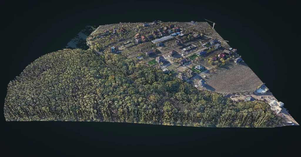
Terrain, buildings, vegetation and water. The study explains the data and site-specific limitations.
View the case study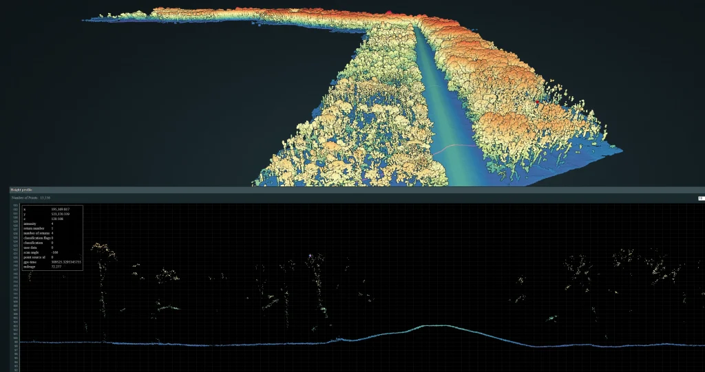
A LiDAR point cloud of the embankment and adjacent terrain, explaining control and the agreed deliverables.
View the case study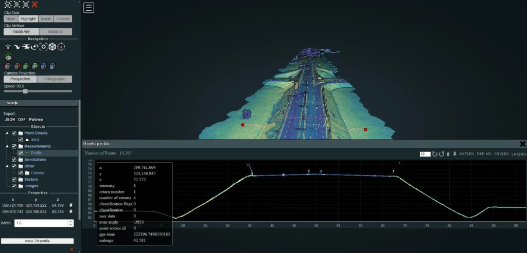
Geometry and classification for an infrastructure corridor; deliverables are defined in the project brief.
View the case study
A photogrammetric study covering 7.4 km² (740 ha). This is the project area.
View the case studyThe images show the type of result. The studies explain the work; available data and exploration functions are those stated on each page.
Explore a real project in the demo
Mention ‘FAE Partner’, your firm, the services of interest and your first project, if you have one. You can start the discussion without a defined project.
Discuss a partnershipAlready have a defined project? Send your request directly through the calculator; one request is sufficient.
Calculate an instant quoteExplore the method in detail: LiDAR for surveying firms · Photogrammetry for surveying firms.
You contract the agreed aerial component. FAE can complement the capacity or configuration you already have.
In subcontracting, your firm remains the client’s contractual point of contact; FAE communicates within the agreed mandate.
After eligible payment is received, in accordance with the agreement established before introducing the project.
Yes. Mention the previous project and the intended result of the new survey; we confirm the requirements and work window.
The quote enables an initial assessment. The urgent deadline starts upon express confirmation of the complete order.
Mention the FAE project, the change you want to track, any new area and the preferred date.
Request a project update